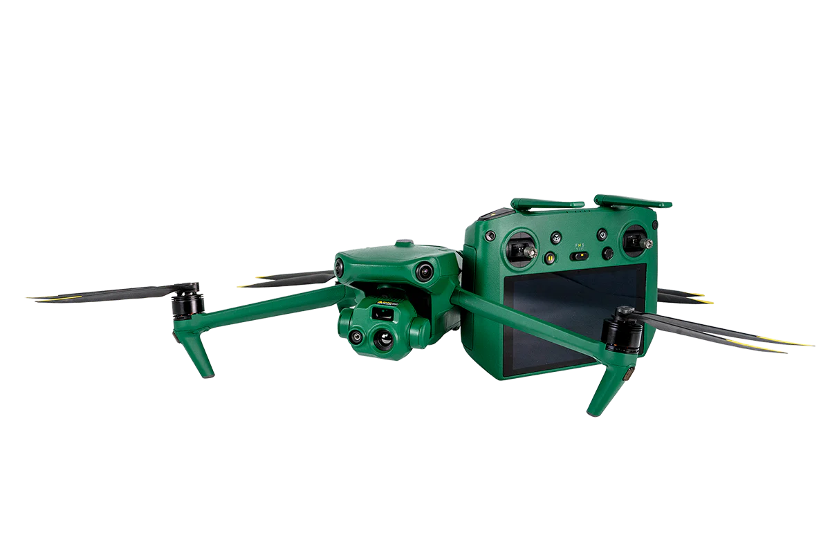
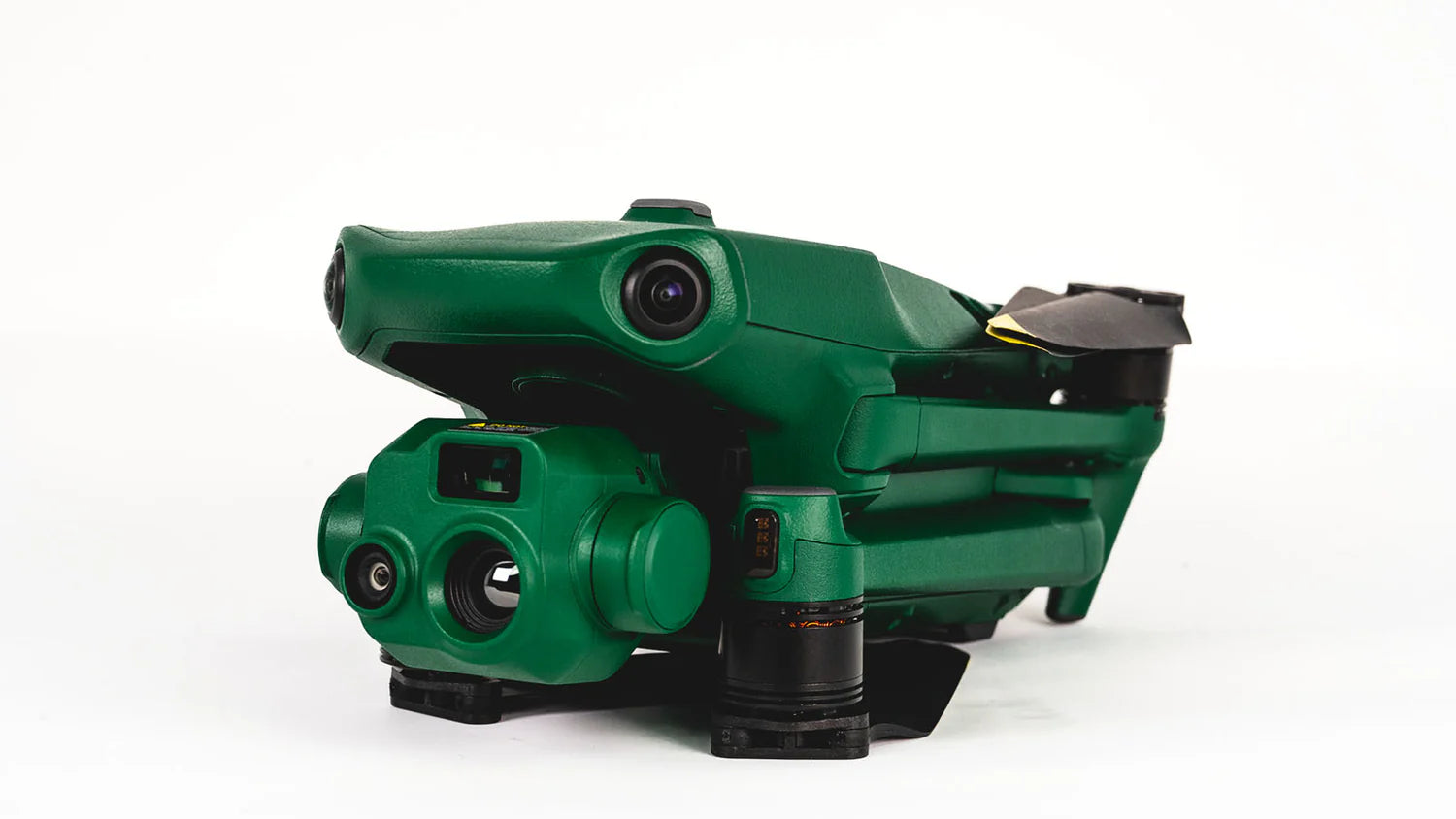
Anzu Raptor T Thermal Drone
Introducing the Anzu Raptor T – a high-performance thermal drone built for mission efficiency, safety, and secure data handling. Engineered for professional use, the Raptor T excels in demanding operations such as infrastructure inspections, public safety, and search and rescue. With up to 45 minutes of flight time per battery, it delivers the endurance needed to capture both thermal and visual data in a single mission.
Key Features
-
High-Resolution Thermal Imaging – 640 × 512 px thermal sensor for detailed heat signatures and accurate data capture.
-
Dual View Capability – Split-screen zoom mode displays thermal and visual feeds side-by-side.
-
RTK Compatibility – Supports centimeter-level positioning for precise mapping and data accuracy.
-
Extended Flight Time – Up to 45 minutes per charge in optimal conditions.
-
Low-Light Performance – Enhanced night and low-light mode for operations in dark environments.
-
Obstacle Avoidance – Advanced sensors for safer navigation in complex or cluttered terrain.
Why Choose the Raptor T
Compact, portable, and mission-ready, the Raptor T combines enterprise-grade thermal imaging with reliable flight performance. It’s designed for organizations that require mobility without sacrificing accuracy, safety, or security, making it a trusted choice for commercial and public safety applications.
SECURITY FIRST
Powered by Aloft Technologies software and with all data hosted on US-based servers, Anzu puts security at the forefront of operations.
INDUSTRY-LEADING SPECS
From low-light operations to precision mapping features, Anzu ensures you have the right capabilities to succeed in your missions.
US-BASED OPERATIONS
Anzu is headquartered and operated within the United States, giving you the peace of mind that your solution is delivered by your neighbors.
The Power Of A Raptor

Ultimate Portability
The Anzu Raptor T offers big power in small solution, with extensive flight times of up to 45 minutes. Pilots can easily carry the Anzu Raptor T around to a variety of missions, without losing enterprise functionality such as RTK, thermal imaging, and low-light mode.

Enterprise Functionality
Anzu Raptor T delivers excellence in mapping missions with accurate positioning through RTK (no GCPs required), thermal capabilites, 56x hybrid zoom, and low-light mode to improved performance in darkened areas.

No Geofencing
Anzu does not impose airspace restrictions like geofencing. We firmly believe that compliance with regulations and responsible drone usage lies with the user, which is why Anzu Robotics’ drones do not have any geofencing enabled. Prior to flying, it is essential for all users to confirm their awareness and adherence to pertinent laws. Our Air Control app, powered by Aloft, actively promotes compliance by aiding users in obtaining airspace approvals and maintaining records of all active approvals.

9-Mile Range
The Anzu Raptor-series drones leverage world-class connectivity technology giving users reliable control and data feed from the drone up to nine miles.