


Description
Payment & Security
Your payment information is processed securely. We do not store credit card details nor have access to your credit card information.
You may also like
Recently viewed
Let customers speak for us
Great product, quality parts, adds amazing immersion to flight, and racing. Even kayaking in VR.
Also... This is the first time I have used RoboTechWave. They are awesome! Polite, helpful, quick replies, great communication. I wish more companies were like this!

I just set up the Racing Motion Simulator Platform 3-Axis and it has completely changed how I experience racing games. The movement feels smooth and realistic, really matching what’s happening on screen so it draws you into every lap. Assembly was surprisingly straightforward and once it was dialed in the range of motion makes a big difference from a static seat setup. It’s sturdy and responsive, and even long sessions stay comfortable which is great for practicing or just unwinding after work. This has become one of my favorite pieces of gear and I’m genuinely glad I bought it.
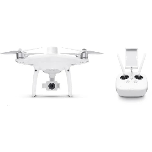
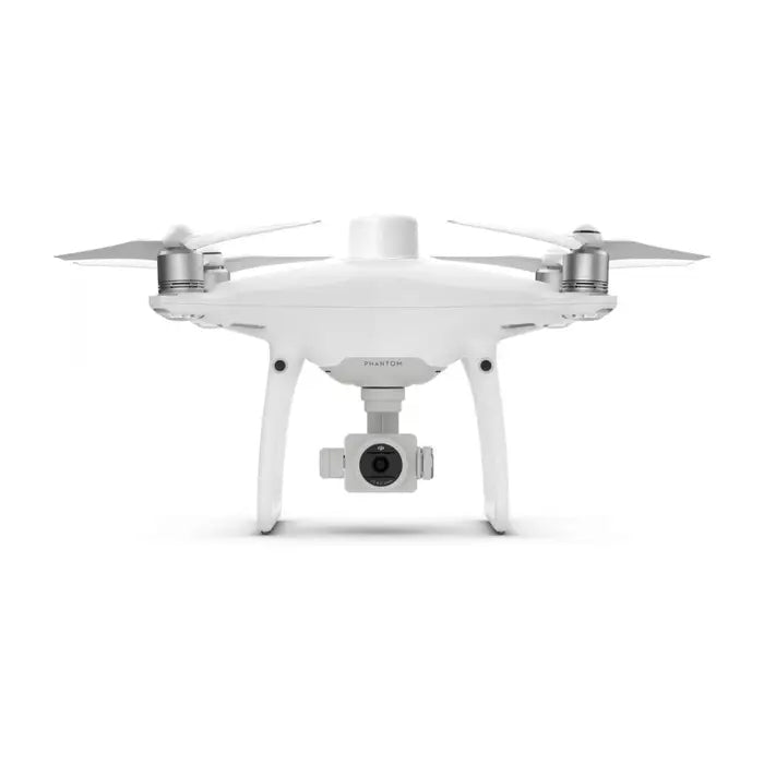
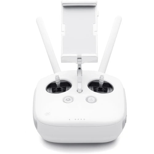
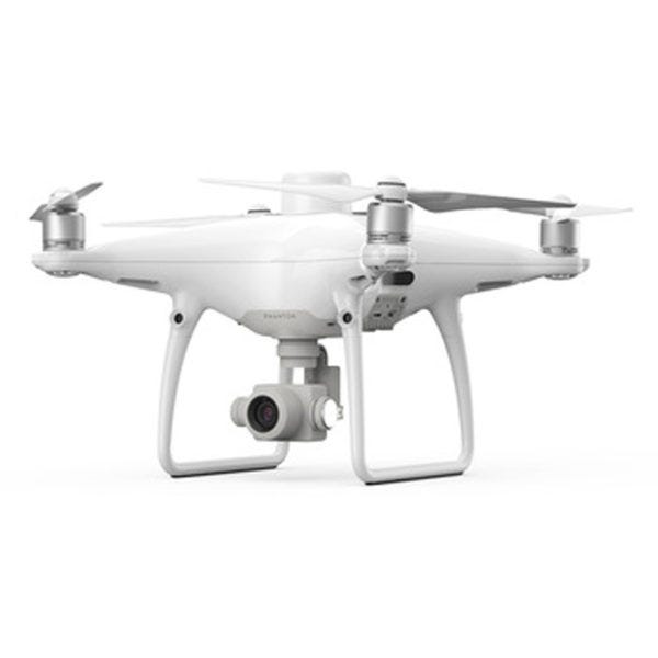
I recently bought the DJI Mavic 3 Enterprise with the Care Plus warranty and I’ve been really impressed with how capable this drone is for professional tasks. The camera quality is sharp and reliable which makes inspections and mapping much easier, and the flight performance is smooth and stable even in less than perfect conditions. I also appreciate having the Care Plus coverage because it gives me peace of mind knowing I have support if anything goes wrong. For the price and what it delivers, this drone has become a dependable part of my workflow and I’m glad I chose it.

I bought the DJI Matrice 400 for commercial work and it has been extremely reliable so far. The build quality feels solid and professional from the first flight, and the long flight time makes a big difference when running extended inspections or mapping missions without constantly landing to swap batteries. It handles wind well, stays stable with payloads, and the obstacle sensing gives extra confidence when flying near structures. Setup was straightforward and it quickly became part of my regular workflow. It is a serious investment, but for professional operations it delivers the performance and reliability I was looking for.

I bought the DJI Mavic 4 Pro Fly More Combo for better video and longer flight times and it’s been awesome. The camera is super clear and the extra batteries in the combo keep me flying way longer than my old drone. Took a little time to learn all the modes but now it feels smooth and predictable in the air. Ordered it from RoboTechWave and when I had questions someone actually replied with real help not just generic stuff. Really glad I got it.

This drone has been a surprise favorite in my gear lineup. It feels solid in flight, the 4K camera captures crisp footage, and the obstacle sensing adds confidence when flying in tighter areas. The Fly More combo is especially useful for longer sessions. Robotechwave’s customer service was quick and helpful, making the whole buying experience smooth.

I picked up the DOF Reality 6-Axis HERO simulator and it’s wild how different racing feels with motion. You do have to spend some time getting it set up right but once it’s going it actually adds a whole new layer to games. Ordered it from RoboTechWave and when I was confused about a few steps someone actually helped me figure it out, which was nice. Really happy I bought it.

The Creality 3D K2 Plus 3D Printer is a powerful large-format 3D printer engineered for professionals, educators, and serious makers who need reliable performance and precision on demanding projects. It features an expansive 350 × 350 × 350 mm build volume, advanced CoreXY motion control, and fast printing speeds (up to ~600 mm/s) for efficient output and crisp detail. With an enclosed heated chamber, AI-enabled monitoring, automatic leveling, and broad filament compatibility, this printer handles functional prototypes, large components, and creative designs with confidence.

This HoverAir X1 ProMax exceeded my expectations for a mid-range drone. The flight is smooth and stable, the video quality is sharp, and the controls feel responsive even when flying longer distances. I especially liked how easy it was to get in the air right out of the box. Robotechwave’s customer service was quick to answer my questions and made the whole buying experience simple and reassuring.

Bought the HoverAir X1 ProMax drone to mess around with aerial shots and it’s actually solid. The controls feel good, video is smooth, and it doesn’t freak out in light wind like some cheaper drones I had. Took a bit to get the hang of the settings but once dialed in it’s fun to fly. Got it from RoboTechWave and when I had questions someone helped me sort them out instead of just leaving me hanging. Good buy so far.
The Professional Motion Simulator Platform 3 Axis Pro delivers a smooth, realistic motion experience for flight sims, racing games, and training setups. Its three axes of movement recreate pitch, roll, and yaw with responsive, stable performance, giving you that immersive feel without lag. Sturdy build quality and easy setup make it a solid option for serious sim enthusiasts or professionals looking to elevate training realism.

This 6-axis motion simulator takes my racing and flight sims to a completely new level. The movement feels incredibly smooth and precise, making every turn and maneuver feel real. Setup took some time, but once it’s dialed in the immersion is next-level. Robotechwave’s customer service was helpful and responsive, making the buying experience smooth and reassuring.

Got the Raise3D Pro2 Plus for some larger parts I needed to print and it’s been solid. Prints come out clean and it handles big jobs way better than my old printers. Took a bit of fiddling to get settings right, but once you find them it’s been reliable. Bought it from RoboTechWave and the people who helped me were actually cool, answered questions and didn’t make me feel dumb. Would buy again.

The Raise3D Pro2 Plus is a professional-grade large-format 3D printer engineered for demanding prototyping, manufacturing, and custom production tasks. Featuring a massive build volume of up to 305 × 305 × 605 mm, dual extruders with electronic lifting, and precision motion control, it delivers high-quality prints with versatile material compatibility and reliable performance. Advanced features like a 7″ touchscreen, HEPA air filtration, resume-after-power-loss, and wireless connectivity make it ideal for continuous operation in professional workshops
The DJI Mavic 3 Enterprise with Care Plus Warranty takes everything you love about the Mavic line and adds powerful enterprise features like long battery life, reliable obstacle sensing, and modular accessories for mapping and inspection jobs. The included Care Plus warranty gives peace of mind for heavy use in the field, making it a dependable choice for professionals who need versatile performance and strong support. Easy to fly, rugged enough for daily work.