



Description
Intelligent Plant Monitoring for Precise Actions
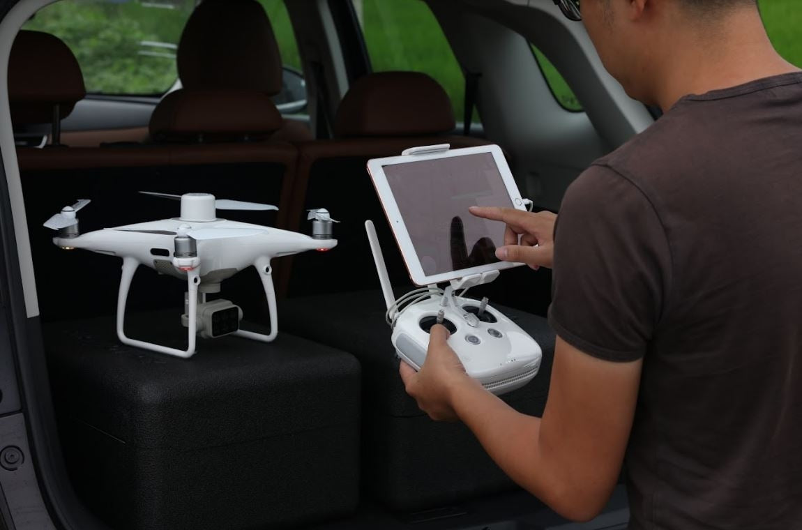
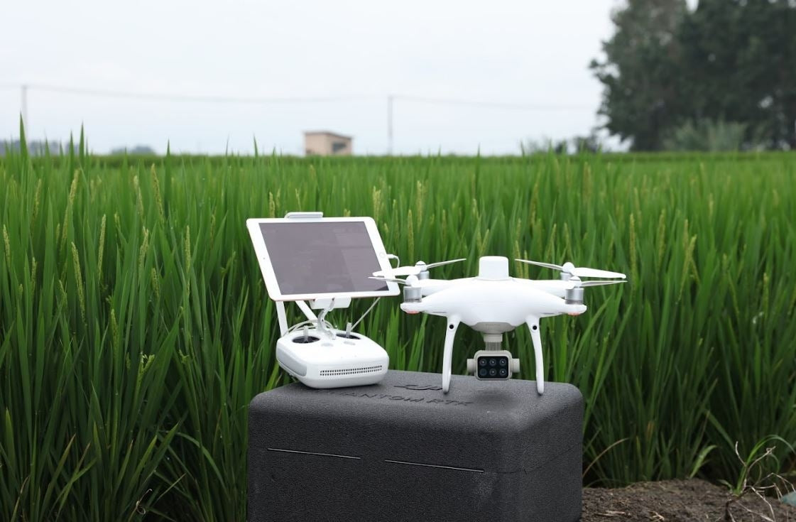
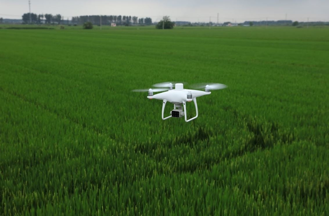
Collect detailed, plant-level information with the P4 Multispectral — a highly accurate drone equipped with an integrated multispectral imaging system designed specifically for agriculture, environmental monitoring, and related applications.
From Fields to Data
Get instant insights into crop health
The P4 Multispectral simplifies the process of gathering data that reveals the condition of crops and vegetation. Built with DJI’s trusted high-performance standards, it offers up to 27 minutes of flight time and a transmission range of up to 7 km thanks to the OcuSync system.

Uncover What Lies Beneath
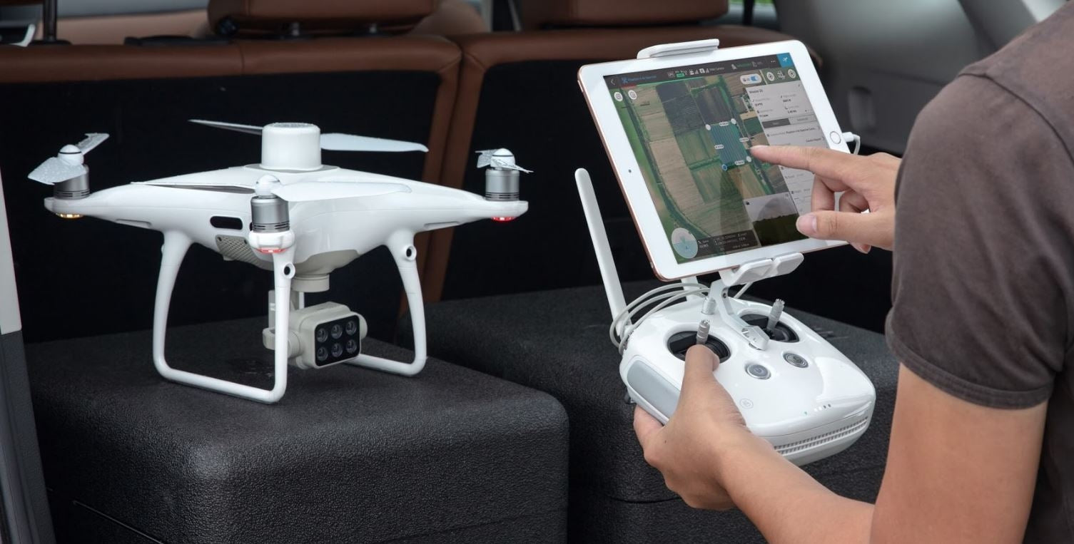
Collecting agricultural imagery has never been easier or more efficient, thanks to a built-in stabilized imaging system that delivers detailed data sets straight out of the box. The drone features one RGB camera plus a multispectral camera array with five 2MP cameras capturing Blue, Green, Red, Red Edge, and Near Infrared bands—all stabilized on a 3-axis gimbal with a global shutter for precise imaging.
Built-in Spectral Sunlight Sensor for Enhanced Accuracy
A spectral sunlight sensor mounted atop the drone measures solar irradiance, ensuring data collection remains accurate and consistent throughout different lighting conditions during the day. When combined with post-processed data, this sensor helps produce highly precise NDVI (Normalized Difference Vegetation Index) results.
Actionable Data at Your Fingertips
Access both RGB and NDVI visuals
For agriculture professionals, just having aerial images isn’t enough. Easily toggle between live RGB footage and a preliminary NDVI analysis to quickly identify areas requiring attention, enabling faster, targeted decision-making for crop treatment.

Centimeter-Level Accuracy
Experience real-time, precise positioning for images captured by all six cameras, enabled by DJI’s TimeSync system. This system constantly synchronizes the flight controller, RGB and narrow-band cameras, and the RTK module, anchoring positioning data to the center of the CMOS sensor to ensure every photo carries the most accurate metadata. Each camera undergoes thorough calibration to measure radial and tangential lens distortions, with these distortion details embedded in the image metadata, allowing post-processing software to make tailored corrections for every user.
D-RTK 2 Mobile Station & NTRIP Support
Improve RTK positioning accuracy even without internet access by linking the P4 Multispectral to the D-RTK 2 High Precision GNSS Mobile Station or using NTRIP (Network Transport of RTCM via Internet Protocol). Alternatively, satellite observation data can be saved for Post Processed Kinematics (PPK) after the flight.
Flight Planning
Use DJI’s GS PRO, a leading iOS flight planning app, to design routes, carry out automated missions, and manage flight data seamlessly.
Data Capture
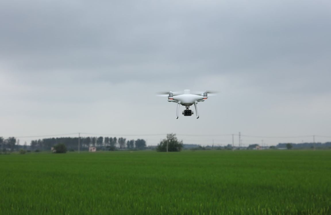
Efficiently gather multispectral images over large areas with the P4 Multispectral, gaining a clear overview of crop or vegetation issues.
Data Analysis
Quickly access and interpret aerial data by applying plant-specific indices and parameters, producing actionable insights into plant health.
Data-Driven Action
Make precise, targeted interventions based on the drone’s accurate data to address specific problem areas effectively.

Precision Agriculture
Across all growing seasons, multispectral imagery offers agricultural professionals valuable insights that are invisible to the naked eye by capturing data across the electromagnetic spectrum. With access to this information and derived vegetation indices like NDRE and NDVI, farmers can make timely, well-informed decisions on crop management, helping to reduce costs, conserve resources, and boost yields.
Environmental Monitoring and Inspection
Regular inspections and maintenance involving vegetation become more intelligent and efficient with the P4 Multispectral. Utilize its actionable multispectral data to track forest health, estimate biomass, map shorelines, manage riparian vegetation, and protect ecosystems and habitats, among many other applications.
How does the P4 Multispectral differ from the Phantom 4 RTK?
Both drones feature RTK-enabled, all-in-one platforms. The key difference lies in their cameras: the P4 Multispectral includes an RGB camera plus a 5-camera multispectral array (each 2 MP), while the Phantom 4 RTK has a single 20 MP RGB camera.
What propellers does the P4 Multispectral use?
It uses 9455S Low-Noise Propellers. Phantom 4 Series propellers can also fit but may affect flight performance.
How should I care for the Spectral Sunlight Sensor?
Avoid contact with sharp or hard objects to prevent scratches.
What are the capabilities of the multispectral camera array?
The multispectral system detects light reflectance from different objects through its cameras to calculate vegetation indices like NDVI, helping assess plant health. The sunlight sensor compensates for changing sunlight throughout the day for consistent data.
What spectral bands do the multispectral cameras cover?
-
Blue (450 nm ±16 nm)
-
Green (560 nm ±16 nm)
-
Red (650 nm ±16 nm)
-
Red Edge (730 nm ±16 nm)
-
Near-Infrared (840 nm ±26 nm)
Each sensor offers about 2.08 MP resolution.
What is the focal length of each camera?
Each lens has a focal length of 5.74 mm (equivalent to 40 mm in 35 mm format).
Are the cameras radiometrically calibrated?
Yes, calibration occurs when processing images via DJI GS Pro or DJI Terra’s vegetation index features.
Is image position compensation applied?
Yes, the relative positions of the six cameras’ sensors to the D-RTK antenna center are calibrated and recorded in each image’s metadata.
Have the lenses been corrected for distortion or vignetting?
Original images are not corrected but distortion and vignetting parameters are measured during production and stored in image metadata for post-processing adjustments.
Is TimeSync available for all six cameras?
Yes, all six cameras benefit from the TimeSync system.
Do I need a high-speed SD card?
Yes, refer to the user manual for recommended SD card specifications.
How is consistency ensured across different P4 Multispectral units?
Each drone undergoes standardized calibration for cameras and sensors to minimize variations.
Do images store DN values or reflectance?
Images store Digital Number (DN) values.
Which remote controller works with the P4 Multispectral?
It is compatible only with the SDK Remote Controller included with the drone.
Can other Phantom 4 Series remote controllers be used?
You can pair them but won’t be able to control the P4 Multispectral unless using the correct controller. The P4 Multispectral controller can control the Phantom 4 RTK, but not vice versa.
What is the maximum transmission distance?
Up to 7 km (NCC/FCC) or 5 km (SRRC/CE/MIC/KCC) in interference-free, unobstructed conditions.
What is the transmission resolution?
720p video transmission.
Can the P4 Multispectral battery be used on the Phantom 4 RTK?
Yes.
How long does the battery last?
About 27 minutes per charge.
How long to charge the battery?
Approximately 58 minutes.
How do I update firmware?
Use DJI Assistant 2 for Phantom and follow official instructions.
What apps are available for flight planning and inspection?
DJI GS Pro comes pre-installed for mission planning and execution.
Which map service does GS Pro use?
Apple Maps.
Are there limits on waypoints per mission?
No limit on waypoints, but actions can only be set on up to 99 waypoints per group. Missions with more than 99 waypoints are divided automatically.
Flight limits?
Max altitude: 500 m; min altitude: 1 m.
Flight speed: 1 m/s to 15 m/s.
How to switch between RGB and NDVI live feeds?
Switch in manual mode. It’s recommended to stay in RGB view during missions. JPEG images save automatically based on the camera mode used.
Recommended camera settings for beginners?
Use Auto mode, Average Metering, and enable AE lock.
Does the P4 Multispectral support third-party software?
DJI Mobile SDK support is coming soon.
Which vegetation indices are supported in DJI Terra?
NDVI, GNDVI, NDRE, LCI, and OSAVI (but DJI Terra lacks an index calculator).
What crops can the P4 Multispectral data be used for?
It supports a wide variety of crops and vegetation. Use DJI Terra or third-party software to create vegetation index maps for health monitoring.
Can I run repeatable inspection missions?
Yes, via GS Pro mission planning.
Can I use third-party software to reconstruct maps?
Yes.
How to calculate flight altitude for a desired Ground Sample Distance (GSD)?
GSD = (Flight Height in meters) / 18.9 (cm/pixel). Calculate altitude accordingly based on needed accuracy.
Max mapping area per flight?
Approximately 0.47 km² at 180 m altitude (GSD ~9.52 cm/pixel).
Do waypoints include altitude data?
Photos taken at waypoints record relative altitude (relative to takeoff).
Is the P4 Multispectral compatible with third-party base stations?
No radio connection support, but it can connect to network RTK servers via NTRIP over 4G/Wi-Fi. Satellite data can be saved onboard for post-processed kinematics (PPK).
Payment & Security
Your payment information is processed securely. We do not store credit card details nor have access to your credit card information.
You may also like
Recently viewed
Let customers speak for us
Great product, quality parts, adds amazing immersion to flight, and racing. Even kayaking in VR.
Also... This is the first time I have used RoboTechWave. They are awesome! Polite, helpful, quick replies, great communication. I wish more companies were like this!

I just set up the Racing Motion Simulator Platform 3-Axis and it has completely changed how I experience racing games. The movement feels smooth and realistic, really matching what’s happening on screen so it draws you into every lap. Assembly was surprisingly straightforward and once it was dialed in the range of motion makes a big difference from a static seat setup. It’s sturdy and responsive, and even long sessions stay comfortable which is great for practicing or just unwinding after work. This has become one of my favorite pieces of gear and I’m genuinely glad I bought it.
I recently bought the DJI Mavic 3 Enterprise with the Care Plus warranty and I’ve been really impressed with how capable this drone is for professional tasks. The camera quality is sharp and reliable which makes inspections and mapping much easier, and the flight performance is smooth and stable even in less than perfect conditions. I also appreciate having the Care Plus coverage because it gives me peace of mind knowing I have support if anything goes wrong. For the price and what it delivers, this drone has become a dependable part of my workflow and I’m glad I chose it.

I bought the DJI Matrice 400 for commercial work and it has been extremely reliable so far. The build quality feels solid and professional from the first flight, and the long flight time makes a big difference when running extended inspections or mapping missions without constantly landing to swap batteries. It handles wind well, stays stable with payloads, and the obstacle sensing gives extra confidence when flying near structures. Setup was straightforward and it quickly became part of my regular workflow. It is a serious investment, but for professional operations it delivers the performance and reliability I was looking for.

I bought the DJI Mavic 4 Pro Fly More Combo for better video and longer flight times and it’s been awesome. The camera is super clear and the extra batteries in the combo keep me flying way longer than my old drone. Took a little time to learn all the modes but now it feels smooth and predictable in the air. Ordered it from RoboTechWave and when I had questions someone actually replied with real help not just generic stuff. Really glad I got it.

This drone has been a surprise favorite in my gear lineup. It feels solid in flight, the 4K camera captures crisp footage, and the obstacle sensing adds confidence when flying in tighter areas. The Fly More combo is especially useful for longer sessions. Robotechwave’s customer service was quick and helpful, making the whole buying experience smooth.

I picked up the DOF Reality 6-Axis HERO simulator and it’s wild how different racing feels with motion. You do have to spend some time getting it set up right but once it’s going it actually adds a whole new layer to games. Ordered it from RoboTechWave and when I was confused about a few steps someone actually helped me figure it out, which was nice. Really happy I bought it.

The Creality 3D K2 Plus 3D Printer is a powerful large-format 3D printer engineered for professionals, educators, and serious makers who need reliable performance and precision on demanding projects. It features an expansive 350 × 350 × 350 mm build volume, advanced CoreXY motion control, and fast printing speeds (up to ~600 mm/s) for efficient output and crisp detail. With an enclosed heated chamber, AI-enabled monitoring, automatic leveling, and broad filament compatibility, this printer handles functional prototypes, large components, and creative designs with confidence.

This HoverAir X1 ProMax exceeded my expectations for a mid-range drone. The flight is smooth and stable, the video quality is sharp, and the controls feel responsive even when flying longer distances. I especially liked how easy it was to get in the air right out of the box. Robotechwave’s customer service was quick to answer my questions and made the whole buying experience simple and reassuring.

Bought the HoverAir X1 ProMax drone to mess around with aerial shots and it’s actually solid. The controls feel good, video is smooth, and it doesn’t freak out in light wind like some cheaper drones I had. Took a bit to get the hang of the settings but once dialed in it’s fun to fly. Got it from RoboTechWave and when I had questions someone helped me sort them out instead of just leaving me hanging. Good buy so far.
The Professional Motion Simulator Platform 3 Axis Pro delivers a smooth, realistic motion experience for flight sims, racing games, and training setups. Its three axes of movement recreate pitch, roll, and yaw with responsive, stable performance, giving you that immersive feel without lag. Sturdy build quality and easy setup make it a solid option for serious sim enthusiasts or professionals looking to elevate training realism.

This 6-axis motion simulator takes my racing and flight sims to a completely new level. The movement feels incredibly smooth and precise, making every turn and maneuver feel real. Setup took some time, but once it’s dialed in the immersion is next-level. Robotechwave’s customer service was helpful and responsive, making the buying experience smooth and reassuring.

Got the Raise3D Pro2 Plus for some larger parts I needed to print and it’s been solid. Prints come out clean and it handles big jobs way better than my old printers. Took a bit of fiddling to get settings right, but once you find them it’s been reliable. Bought it from RoboTechWave and the people who helped me were actually cool, answered questions and didn’t make me feel dumb. Would buy again.

The Raise3D Pro2 Plus is a professional-grade large-format 3D printer engineered for demanding prototyping, manufacturing, and custom production tasks. Featuring a massive build volume of up to 305 × 305 × 605 mm, dual extruders with electronic lifting, and precision motion control, it delivers high-quality prints with versatile material compatibility and reliable performance. Advanced features like a 7″ touchscreen, HEPA air filtration, resume-after-power-loss, and wireless connectivity make it ideal for continuous operation in professional workshops
The DJI Mavic 3 Enterprise with Care Plus Warranty takes everything you love about the Mavic line and adds powerful enterprise features like long battery life, reliable obstacle sensing, and modular accessories for mapping and inspection jobs. The included Care Plus warranty gives peace of mind for heavy use in the field, making it a dependable choice for professionals who need versatile performance and strong support. Easy to fly, rugged enough for daily work.